




India’s First Soil Texture Map: A New Digital Tool for Smarter Agriculture
Agriculture | JaanoAndSeekho.in
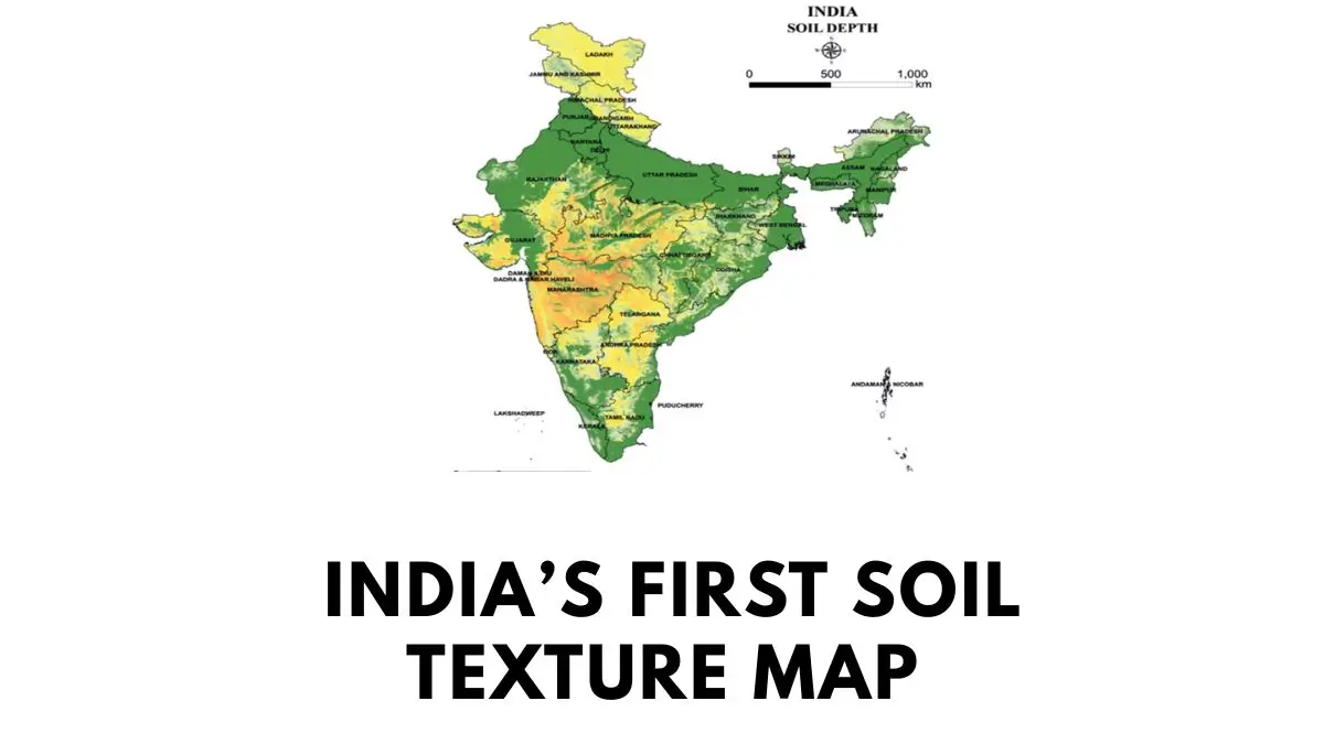
India has taken an important step towards data-driven and precision agriculture with the development of its first-ever national Soil Texture Map by the National Bureau of Soil Survey and Land Use Planning (NBSS&LUP), an institute under the Indian Council of Agricultural Research (ICAR).
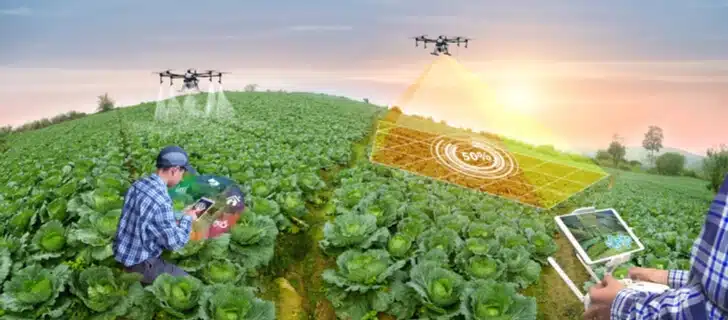
Launched on 16 July 2026, the digital map provides soil-texture information at an exceptionally detailed one-hectare resolution. By combining conventional soil surveys with field observations, remote sensing, satellite data, geospatial technologies and artificial intelligence, the initiative aims to provide farmers, scientists and policymakers with more precise information about India’s diverse soils.
The development could become an important resource for crop planning, irrigation management, precision farming, soil classification and sustainable land-use planning.
What Is a Soil Texture Map?
A soil texture map is a digital representation showing how different soil textures are distributed across geographical areas.
Soil texture is primarily determined by the relative proportion of three mineral particles:
- Sand
- Silt
- Clay
The proportion of these particles influences several important physical properties of soil, including how quickly water moves through it, how much moisture it can retain, how well air circulates through the soil and which crops are likely to perform better.
The new Indian Soil Texture Map converts this information into a high-resolution digital database, allowing variations in soil texture to be examined at a much finer geographical scale than conventional broad regional soil maps.
Understanding Soil Texture
Soil may appear relatively uniform to the naked eye, but its physical characteristics can vary considerably from one location to another.
Sandy Soil
Soils containing a relatively high proportion of sand generally have larger spaces between particles. Water can therefore move through them relatively quickly.
Such soils may have:
- Faster drainage
- Lower water-retention capacity
- Greater risk of moisture loss
- Different irrigation requirements compared with clay-rich soils
Clay-Rich Soil
Clay particles are much smaller and can retain considerably more water than sand.
Clay-rich soils may therefore have:
- Higher water-holding capacity
- Slower drainage
- Greater moisture retention
- Different crop and irrigation requirements
Silt-Rich Soil
Silt particles are intermediate in size between sand and clay. Their physical behaviour and agricultural suitability depend on their proportion and combination with other soil particles.
In reality, most agricultural soils contain mixtures of sand, silt and clay. Understanding that combination is therefore essential for making informed decisions about crops and water management.
How Was the Soil Texture Map Developed?
Creating a soil map at such a detailed scale requires the integration of multiple sources of information.
NBSS&LUP combined traditional soil-mapping approaches with modern digital technologies. Field observations provide ground-level information, while remote sensing and satellite imagery help extend the understanding of soil characteristics across large geographical areas.
Artificial intelligence and geospatial analysis can then be used to integrate these datasets and identify patterns in soil texture.
The resulting database provides soil-texture information at one-hectare resolution, offering a substantially more granular view of soil characteristics.
Why One-Hectare Resolution Matters
One of the most important features of the initiative is its high spatial resolution.
Large-scale soil maps can describe the general characteristics of an entire region, but agricultural conditions may vary significantly within a relatively small area.
Two neighbouring fields—or even different portions of the same agricultural landscape—may have differences in:
- Soil texture
- Water movement
- Moisture retention
- Drainage
- Crop suitability
A hectare-level database can help capture some of these variations and potentially make agricultural recommendations more location-specific.
This is particularly relevant to precision agriculture, where decisions are increasingly based on detailed information about individual fields rather than broad regional averages.
Potential Applications in Indian Agriculture
1. Better Crop Planning
Different crops perform differently under different soil and water conditions.
The Soil Texture Map can support crop-suitability assessment, helping agricultural planners identify crops better adapted to specific soil characteristics.
Instead of relying solely on broad regional classifications, farmers and agricultural agencies can potentially use more detailed soil information when planning cultivation.
2. Improved Irrigation Planning
Soil texture strongly influences water movement and moisture retention.
Sandy soils generally allow water to move more rapidly, while clay-rich soils can retain water for longer periods.
Detailed soil-texture information can therefore support more efficient irrigation planning by helping determine where water management strategies need to differ.
This could be particularly valuable in regions facing water scarcity and increasing pressure on groundwater resources.
3. Supporting Precision Agriculture
Precision agriculture seeks to move away from a one-size-fits-all approach.
Instead of treating an entire agricultural area identically, farmers can increasingly make decisions according to local conditions.
A high-resolution soil database can contribute to this approach by providing information that can be integrated with other datasets such as:
- Crop information
- Weather data
- Irrigation data
- Satellite imagery
- Farm-management systems
4. Village-Level Agricultural Planning
The map could also support government agencies and agricultural planners in developing more location-specific strategies.
At the village or local level, information about soil characteristics could assist with decisions related to:
- Crop selection
- Irrigation infrastructure
- Agricultural resource allocation
- Land-use planning
- Soil-management programmes
5. Land-Use Planning
Soil characteristics are an important component of sustainable land-use decisions.
Detailed soil information can help planners better understand which areas may be more suitable for particular agricultural activities and where soil and water conservation measures may be necessary.
Why the Map Is Significant for India
India has an enormous diversity of soils, climatic conditions and agricultural systems. The same broad region can contain considerable variation in soil properties.
At the same time, Indian agriculture includes millions of relatively small farms, making highly localized information increasingly valuable.
This is where a high-resolution digital soil database can make a difference.
Rather than viewing soil characteristics only through broad regional classifications, researchers and planners can work with more detailed spatial information.
The initiative therefore represents more than the creation of another agricultural map. It is an important step towards building a digital foundation for more precise, location-specific agricultural decision-making.
Soil Data Meets Artificial Intelligence
One of the notable aspects of the project is the integration of artificial intelligence with conventional soil science.
Agricultural datasets can be enormous, particularly when field observations, satellite imagery, remote sensing and geospatial information are combined.
AI-based analytical approaches can help identify relationships and patterns within these datasets, potentially allowing soil characteristics to be estimated and mapped across areas where direct observations are limited.
The combination of soil science + remote sensing + geospatial technology + AI illustrates how traditional agricultural research is increasingly becoming part of India’s broader digital transformation.
A Step Towards Smarter and More Sustainable Farming
The Soil Texture Map could become a valuable resource for researchers, farmers, agricultural extension workers, policymakers and planners.
Its greatest potential lies in converting complex soil information into practical knowledge that can support better decisions about what to grow, where to grow it and how to manage water and land resources.
As agriculture faces challenges such as water scarcity, changing climatic conditions, soil degradation and the need to improve productivity sustainably, detailed soil intelligence can become increasingly important.
India’s first national Soil Texture Map is therefore a significant development in the country’s journey towards precision agriculture and data-driven land management.
Key Takeaways
- Developed by: National Bureau of Soil Survey and Land Use Planning (NBSS&LUP), under ICAR
- Launched: 16 July 2026
- Resolution: One hectare
- Core information: Distribution and characteristics of soil texture
- Technology involved: Field observations, remote sensing, satellite data, geospatial analysis and AI
- Major applications: Crop planning, irrigation planning, precision agriculture, soil classification and land-use planning
- Major significance: Enables more detailed, location-specific understanding of India’s agricultural soils
Conclusion
India’s first Soil Texture Map marks an important intersection of agriculture, soil science and digital technology.
By providing soil-texture information at hectare-level resolution, the initiative has the potential to make agricultural planning more precise and evidence-based. From selecting suitable crops and managing irrigation to supporting precision farming and government-level land-use planning, detailed soil intelligence can play a growing role in India’s agricultural future.
The real value of the map will ultimately depend on how effectively its data is integrated into field-level decision-making. If connected with farmer advisory systems, digital agriculture platforms, weather information and precision-farming technologies, it could become a powerful tool for building a more efficient, resilient and sustainable agricultural ecosystem in India.
Keywords: India Soil Texture Map, NBSS&LUP, ICAR, Soil Texture, Indian Agriculture, Precision Agriculture, Soil Mapping, AI in Agriculture, Irrigation Planning, Crop Planning, Digital Agriculture, Sustainable Farming
Meta Description: India’s first Soil Texture Map, developed by NBSS&LUP, provides hectare-level soil data using field studies, remote sensing and AI to support crop planning, irrigation and precision agriculture.